


The weather across Central Alabama is almost as different as night and day. If you live along or north of a line from Winfield to Jasper to Pinson to Springville to Piedmont, it has been a very wet morning and temperatures are chilly with values in the 50s. If you live along a line from about Reform to Birmingham to Oxford, it has been a cloudy morning and temperatures are in the 60s. And if you live along or south of a line from Aliceville to Tuscaloosa to Columbiana to Lineville, you have seen a mix of sun and clouds with temperatures into the lower and middle 70s. So there is quite a stark contrast across Central Alabama.
Rainfall in the area which has been getting rain off and on all morning now totals between one half and one and a half inches with some spots potentially verging on as much as 2 inches. The radar estimates below show the area affected today. The brightest green areas have seen amounts estimated to be between 1 and 2 inches while the other green colors represent one half to 1 inch of rain. And this rain area continues to show signs of training with little southward movement of the overall rain area.
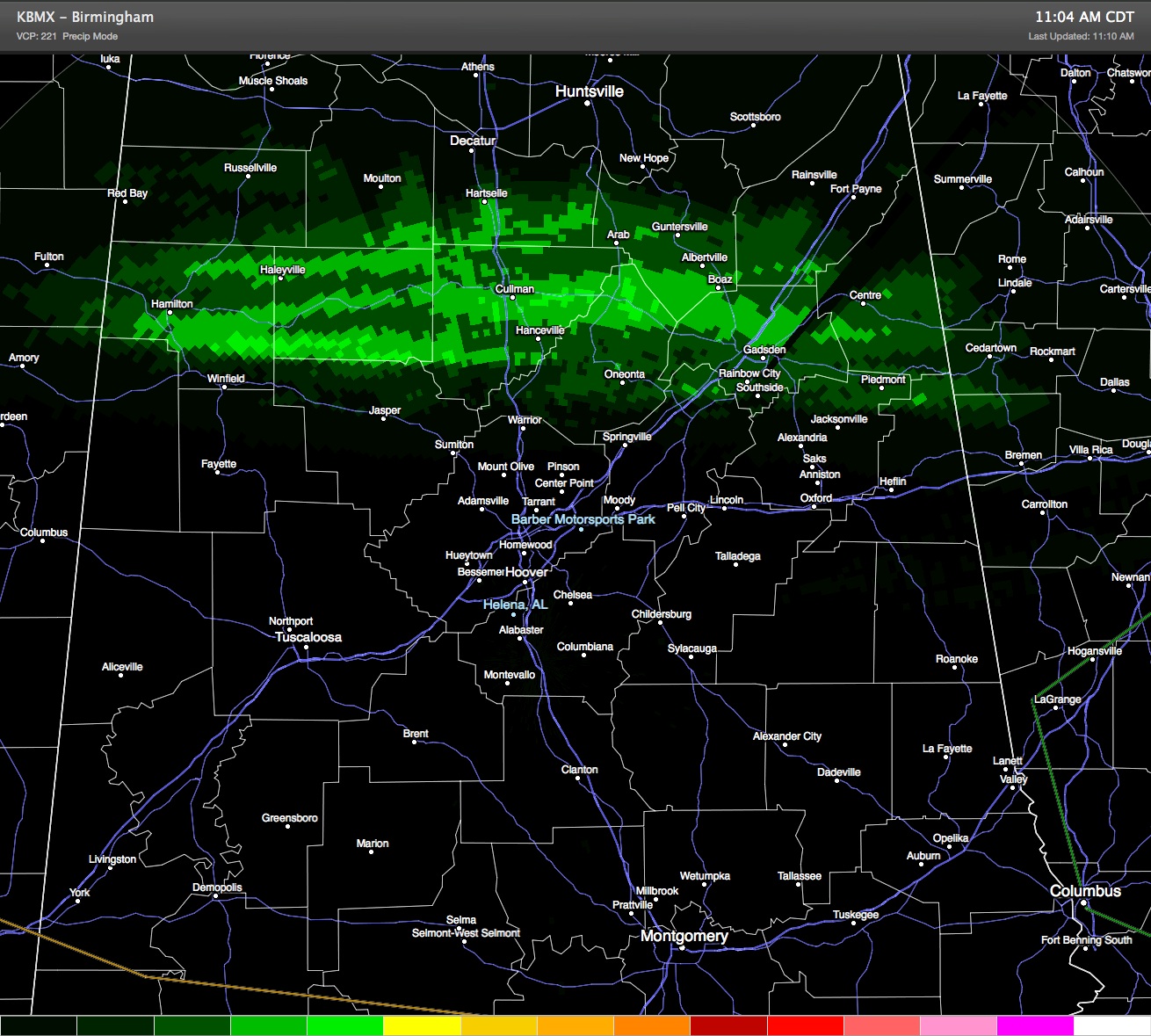
Rainfall Estimates as of 11:00 am, May 18, 2014
Flash flooding is becoming somewhat concerning due to the training nature of the precipitation. Motorists should be alert to ponding of water on highways and to flooding in low areas where water can collect. Remember, turn around, don’t drown. However, it does appear that the precipitation will be tapering off during the afternoon hours from west to east. Already over northern Mississippi, the rain area has diminished quite a bit but even in the narrow band that was still occurring some briefly heavy downpours are possible. Hopefully by the 3 to 4 pm time frame, rain should be diminishing though the clouds will likely remain into the evening hours.
-Brian-



