


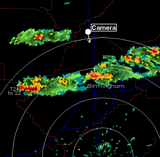
While most of the pictures of the storm that moved through central Alabama on Wednesday were from the south side (as they should be, since any funnel clouds or tornadoes would be visible from that side), Brian Peters and I got a nice view of the storms from the north, in a fairly clear area, allowing us to see the tops of the storms as they moved across Jefferson County. We were near Rickwood Caverns, just off I-65 in Blount County. Ironically, we had only left my house in Trussville 2-3 hours earlier to storm chase, and the storm went right through Trussville. The radar picture shows our location and direction of view.
The time lapse above is about 20 minutes of video, from 230 pm to 250 pm, at 8 times normal speed. It was during this time that funnel clouds were reported in Fultondale and Tarrant City. You can see updrafts billowing upward in the storms, and near the end you can see a pileus cloud above the top of one of the storms. These clouds are formed when the storm updraft pushes air upward out of its way, and ice crystals form in the air as it rises in the moist atmosphere.



