


The broad center of weakening Tropical Storm Ida will move into Mobile Bay shortly. No sense to focus on the low pressure center since the system is now a large area of wind and rain. Wind gusts are generally in the 30 to 40 mph range. The Mobile Airport reports a wind gust to 37 mph; the peak gust at Gulf Shores (Jack Edwards Airport) is only 17 mph. Needless to say, these kind of winds won’t produce any significant damage.
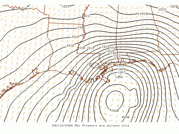
The back edge of the rain is approaching the Alabama coast, so the rain should diminish there after midnight. The rest of Alabama will be wet tonight, and the rain will linger into the day tomorrow. The heaviest rain should be from Mobile to Anniston, where 2 to 3 inches are possible. Looks like around 1 inch for Birmingham, with very light amounts for Northwest Alabama.
BOTTOM LINE: Still looks pretty much like a non-event, with minimal potential for damage and no serious flooding issues. Of course, we will keep an eye on the situation until the system moves out of the state tomorrow afternoon. The rest of the week looks like it will feature some delightful weather.



