


Ike back to Cat Four…
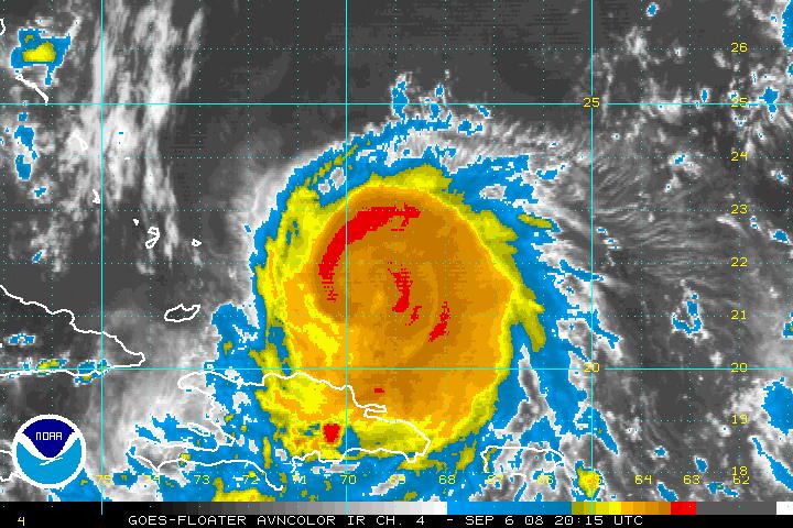
Lots of speculation about the future track of Ike.
First the facts as of 4 p.m. CDT
LOCATION …21.4 N…69.7 W or 810 miles ESE of Key West.
MOVEMENT…WSW at 15 mph
MAX WINDS…increased to 135 mph…now a dangerous Category Four
CENTRAL PRESSURE…949 millibars
WARNINGS
Hurricane warnings for Central and Southeastern Bahamas, Turks and Caicos and eastern Cuba. Hurricane watch for Central Cuba. Tropical storm warning for northern Hispaniola.
THREAT TO FLORIDA
No real change in the official forecast. Still carries it across Cuba on Monday and into the Gulf Tuesday. Main threat to the Keys and South Florida may be lessening, but is still there. Evacuations will be occurring tomorrow for residents of the Keys. It takes at least 48 hours to evacuate the vulnerable island chain.
GULF SCENARIOS
A series of shortwave troughs will dig across the Southeast starting Tuesday. Any of these could pick Ike up. If it happens early, the hurricane could go toward Tampa Bay. Wednesday’s trough could mean a landfall around Apalachicola or Cedar Key. Thursday’s could mean Panama City. The Friday one could mean Destin or Pensacola, may even as far west as the Alabama coast. It is just way to early to tell. Interests from Lafayette LA to Key West must stay in constant contact with the latest information on Ike.
MY THOUGHTS
I think Ike will meander into the northern Gulf by Thursday and hook up with the Friday front. It should begin moving northeast, sort of like 1975’s Hurricane Eloise, making landfall in the Panhandle. It will be a significant wind and heavy rain event for Central and especially Southeast Alabama. It will be very interesting to watch.



