


As the computer models, meteorologists, the news media, and everyone else changes the track of Ike and other tropical systems every 12 hours, it makes me (as a meteorologist who mainly researches the small-scale, ie., thunderstorms), want to know more about how troughs/ridges etc. interact with hurricanes, and whether JB’s theory (see blog post here) about intense hurricanes being pushed around less by surrounding weather systems than weaker ones is backed up by theory (even though it makes sense to me).
In a talk with Dr. Kevin Knupp yesterday, he pointed out that one can simply use the equation for pressure tendency in the atmosphere. Since a hurricane is also an area of intense vorticity (spin), the equation for vorticity tendency should also work. So, I’ll do my best to explain this as I understand it.
Knupp-Coleman Height model (KCH). A hurricane should move toward the area where the pressures are falling the most rapidly. The change in pressure in a tropical environment (or height of an isobaric surface like 500 mb) at a location is related to 1) the flow of vorticity toward that point, and 2) rate of warm-air change above that location. 1) implies that air with spin that is also moving along will keep its spin, and 2) reflects that warm air is less dense than cool air and causes pressure to fall.
The charts below illustrate the flow of vorticity. In the center of the hurricane, even though the vorticity is very high, the air is spinning but not really moving along with the flow. However, in the areas around the hurricane (in this case to the north where a ridge is located), the surrounding flow has an effect on where the vorticity is flowing.
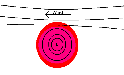
Solid lines indicate isobars, shading represents vorticity.
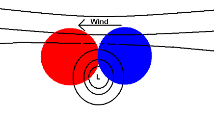
Shading represents flow of vorticity (red is positive, blue is negative).
The above means that the vorticity process tends to move the hurricane NW here, toward the positive flow of vorticity.
The charts below show the warm-air generation above a point. In a hurricane, this is related to thunderstorms releasing heat due to condensation of water, and warmth from the ocean being transported upward.
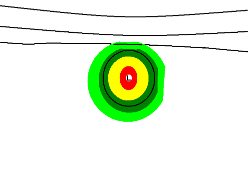
Hurricane warm-air generation due to thunderstorms (green is light, red is heavy)
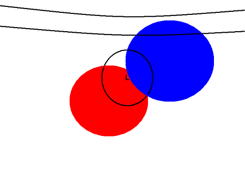
Rate of warm-air change (red is positive, blue is negative)
In this case, notice that the thunderstorms and warm-air generation are reduced somewhat to the north (where shear may disrupt the storms), and to the east where the churned up ocean water is cooler. So, the best warm air transport is to the SW of the storm.
Combining the two effects (one moving the hurricane NW, one moving it SW), assuming they are equal, would mean the storm should move west. So, the ridge to the north is helping to move the storm west by affecting the flow of vorticity, and by shearing off some convection to the north.
Now, suppose that the hurricane is very intense as JB was discussing, making the warm air process stronger anyway, and also reducing the effect of shear to the north. Then, the rate of warm-air change would be more symmetric.
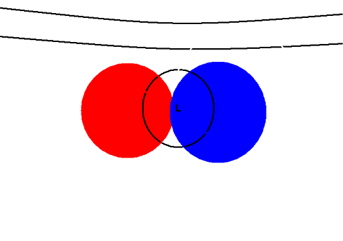
Rate of warm-air change (red is positive, blue is negative).
Now, the combination of the two terms would move the hurricane NW, slightly into the ridge, meaning the ridge is having less of an impact, and validating JB’s theory. This is all very simplified and speculative, but it makes some sense.
Also, remember that just the water in a hurricane weighs 100’s of millions of tons, and even moving 10 mph has an enormous amount of momentum. So, any outside processes should have less of an effect on a larger, more intense hurricane, with more water.
I have not proven JB’s theory, nor have I thoroughly examined the things steering a hurricane, but I’ve given it a try.



