


10 PM FAST FACTS
LOCATION…21.8N/80.8W…OR 200 MILES SSE OF KEY WEST
MOVEMENT…WNW 13
TOP WINDS…80 MPH
CENTRAL PRESSURE…967 MB
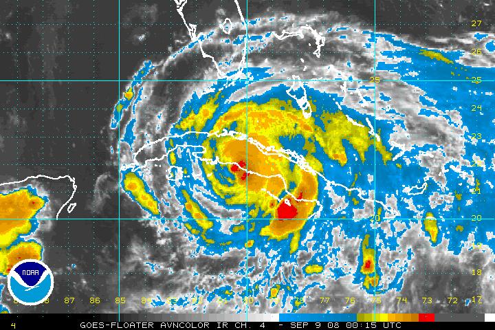
Hurricane Ike is moving west along the South Coast of Cuba tonight. Convection is trying to pop up near the center, but the proximity to land is limiting it.
Ike could strengthen a little through the night before reaching the west end of Cuba during the late morning. A quick transit of the island will put it in the Gulf of Mexico by mid-afternoon.
No real change in the forecast thinking. Most of the models have come around to the idea of a ridge over the Gulf putting up a protective shield from Florida to Louisiana. Great news for battered New Orleans and Louisiana. The global models are all on this theory. Only the regional hurricane models forecast a northward turn, Still, five days is a long time and lots can happen.
There is a fairly wide spread in the eventual landfall based on the early model output from the 0z runs. But it is all centered on the Texas coast. So a landfall between Brownsville and Galveston looks likely now.
The official track carries it to near Corpus Christi late Saturday afternoon. The NAM is a little faster on the 0z run tonight, so that will have to be watched.
We will update you on the GFS output before our bedtime…
Ike should continue to strengthen over the Gulf and will likely be a major hurricane by the time it makes landfall. I think the NHC forecast of 115 mph at 5 days is conservative.
Squalls are over the Florida Keys tonight.
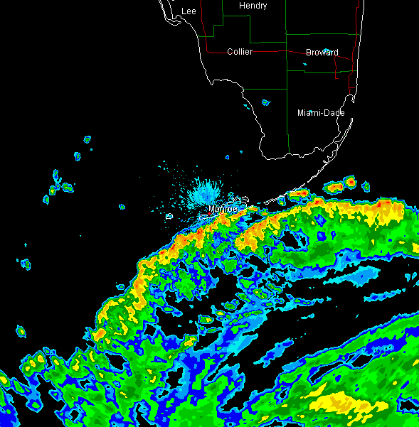
At Key West…winds are ENE 28 G 39…a peak gust of 44 mph was reported in the past hour. Marathon was ENE at 22 G 40. KMIA is E 25 G 33.



