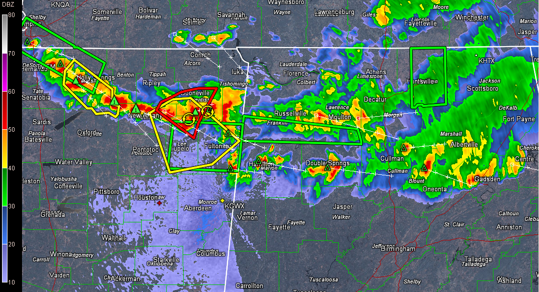
Storms continue to organize tonight over northern Mississippi and a significant damaging wind event could be shaping up. There have been several tornado warnings in the past 90 minutes over northern Mississippi. There have been several reports of funnel clouds. A possible tornado was reported in DeSoto, MS. This is along I-55 south of Memphis.
But it seems the storms are taking on more of an MCS look and this complex of storms will push east southeast into Central Alabama through the late evening hours. Can’t rule out an isolated tornado over northwestern Alabama, but the setup for tornadoes lessens the further southeast you go into Central Alabama.
But the wind threat can produce significant damage. Please make sure you have a reliable source to receive warnings overnight.
Severe storms will reach western Marion County between 930 and 10 p.m.
In Alabama, storms extend across Etowah, Blount, Cullman, Winston and Marion Counties.
None of these storms are severe at this time.