


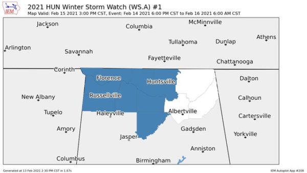
NWS Huntsville has placed much of North Alabama under a Winter Storm Watch that starts at 6:00 pm Sunday night and is expected to expire at 6:00 am Tuesday. Counties included in the watch are Colbert, Franklin, Lauderdale, Lawrence, and Limestone.
…WINTER STORM WATCH IN EFFECT FROM SUNDAY EVENING THROUGH LATE
MONDAY NIGHT…
* WHAT…Heavy mixed precipitation possible. Total snow and sleet
accumulations of up to 3 inches and ice accumulations of one tenth
to one quarter of an inch possible.
* WHERE…Lauderdale, Colbert, Franklin, Lawrence and Limestone
counties.
* WHEN…From Sunday evening through late Monday night.
* IMPACTS…Travel could become extremely hazardous.
* ADDITIONAL DETAILS…Two periods of wintry precipitation are
expected. A period of freezing rain or freezing drizzle is
expected to develop Sunday evening and overnight. This will
produce icy conditions, especially on bridges and overpasses.
A mixture of freezing rain and sleet will develop Monday
afternoon and last into Monday night. The precipitation may mix
with or change to snow for a period Monday night.
PRECAUTIONARY/PREPAREDNESS ACTIONS…
A Winter Storm Watch means there is a potential for significant
snow, sleet, or ice accumulations that may impact travel. Continue
to monitor the latest forecasts.



