


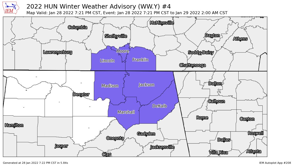
…WINTER WEATHER ADVISORY IN EFFECT UNTIL 2 AM CST SATURDAY…
* WHAT…Snow. Locations at higher elevations have already seen
around a half an inch to an inch and additional snow
accumulations of up to one inch is possible. Most areas at lower
elevations will only see a dusting to around a half an inch
accumulate.
* WHERE…In Alabama, Madison, Marshall, Jackson and DeKalb
counties. In Tennessee, Moore, Lincoln and Franklin TN
counties.
* WHEN…Until 2 AM CST Saturday.
* IMPACTS…Slippery road conditions will be likely at higher
elevations on the Cumberland Plateau, Lookout Mountain, and
Sand Mountain. Elsewhere there may be a few slick spots, mainly
on bridges and overpasses.
PRECAUTIONARY/PREPAREDNESS ACTIONS…
Slow down and use caution while traveling.



