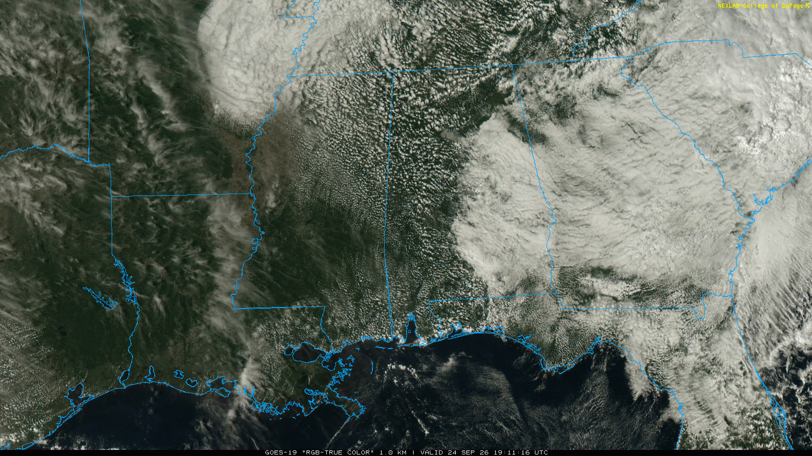
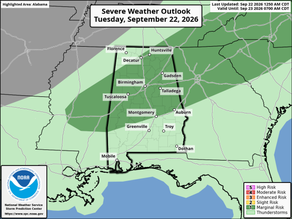
HIT AND MISS STORMS: Scattered showers and storms will develop across Alabama again this afternoon. Like yesterday, some places won’t see a drop, but other communities could see a storm with strong winds, small hail, and very frequent lightning. SPC maintains a “marginal risk” (level 1/5) of severe thunderstorms for much of North and Central Alabama.
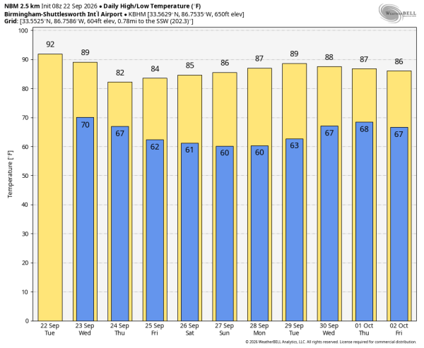
Temperatures will reach the low 90s in most places this afternoon, well above average for mid-September.
A few afternoon storms remain possible tomorrow, mainly over the eastern half of the state.
THURSDAY THROUGH THE WEEKEND: Heat levels come down finally. Highs drop into the low to mid 80s, with morning lows in the upper 50s and low 60s. A few isolated showers are possible Thursday, but most of Alabama should be rain-free Friday through the weekend. Any weekend showers will be isolated, and near the Gulf Coast.
The weather continues to look quiet through much of next week with highs generally in the 80s and lows in the 60s… See the video briefing for maps, graphics, and more details.
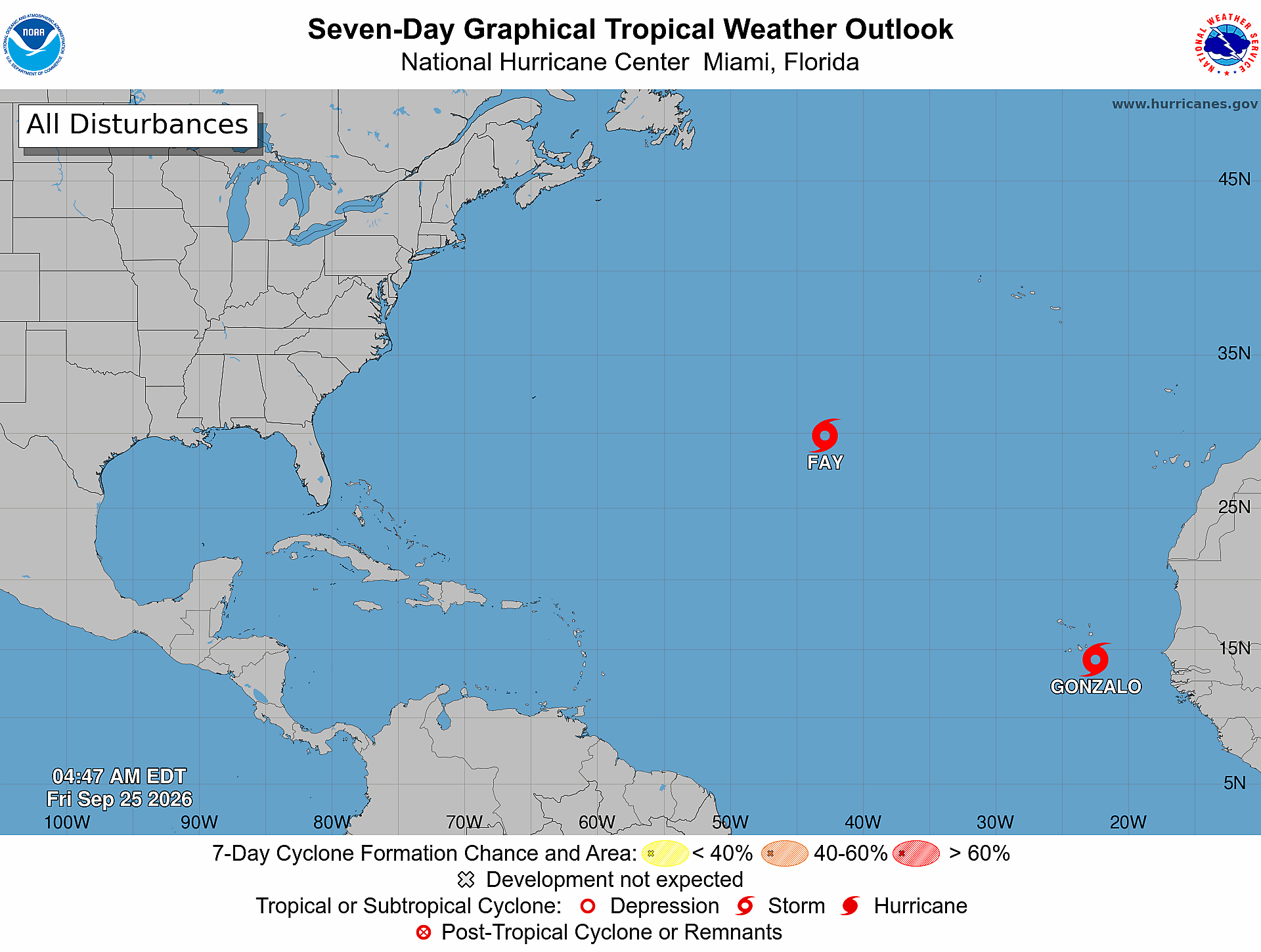
TROPICS: Tropical Storm Fay is about 570 miles southwest of the Azores this morning, and will dissipate today. Elsewhere a tropical wave will move off the coast of Africa tomorrow; NHC gives it a 30 percent chance of development. It will likely gain latitude and will stay in the far eastern Atlantic.
No tropical storms or hurricanes are expected near the Gulf or the U.S. for at least the next 7-10 days as this remarkably quiet hurricane season rolls along.
AUTUMN ARRIVES! For most of the year, one hemisphere tilts toward the sun while the other tilts away. Today marks the moment the Earth’s axis isn’t tilted toward or away from the sun—instead, the sun sits directly above the celestial equator. The result? Nearly equal parts day and night everywhere on Earth. The equinox is this evening at 7:05p CT.
ON THIS DATE IN 2006: The tri-state area of Missouri, Illinois, and Kentucky was struck by the worst tornado outbreak in the recorded history during the month of September. One supercell produced a long-track F4 tornado across southeastern Missouri into southwestern Illinois. This tornado traveled 27.5 miles.
Look for the next video briefing here by 3:00 this afternoon… enjoy the day!