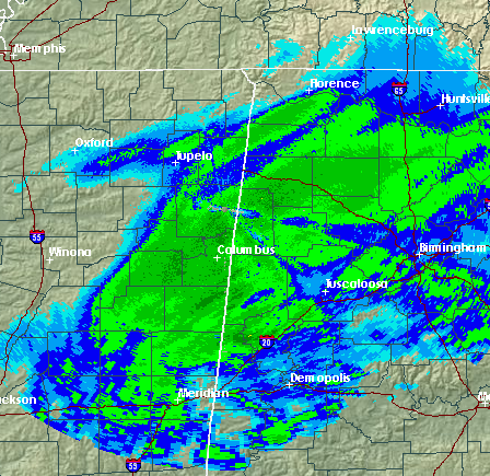
Snow continues in the zone of dynamic lift from central Mississippi into north and central Alabama. The thunderstorms that were developing along the Gulf Coast earlier, that we had some concern would soak up moisture and weaken the snow, have not done so. Therefore, current forecast looks good. We have about 4 more hours of snow in BHM. It has yet to accumulate on anything other than elevated surfaces in the BHM area, and even there it has not been doing so very quickly since temperatures have been above freezing until now.
Over NW Alabama, where temperatures have been below freezing, here are some snow accumulations as of 6:00 to 8:00 pm.
Haleyville 2″
Hamilton 2″
Cuba 1″
Cullman 1″
Parrish 1.5″
Some NW locations like Haleyville, Hamilton, Fayette, and Millport may wind up with 4″ or more of snow before this is over.
Take a look at 8 pm temperatures
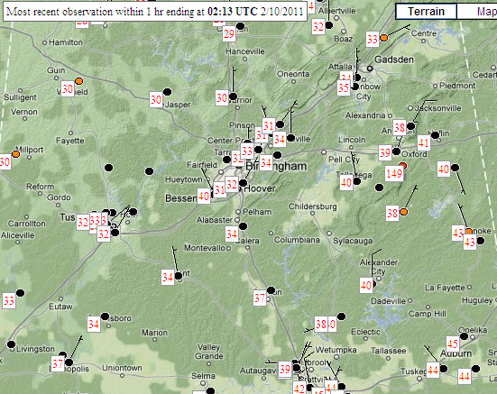
It has now dropped to 32 at BHM airport, and 31 in NE suburbs like Pinson and Trussville. It is also 32 in Bluff Park. Those locations still at 33 or 34, like Tuscaloosa, Alabaster, or Gadsden, will drop to freezing soon. So, snow will begin to accumulate rapidly now over central and eventually east Alabama, and bridges will become very icy in the Birmingham metro area, if they haven’t already. Travel anywhere across north and central Alabama is discouraged for the rest of tonight.
Snow will start to taper off in west Alabama around 10 pm, in BHM area by midnight or so, and in Anniston and Gadsden by 3 am. Most areas will end up with 2-3″ of snow along I-20, with some heavier amounts over NW Alabama.
As far as travel tomorrow morning, temperatures in central Alabama will be in the upper 20s, and with the initial snow melting earlier, bridges and even some surface streets will very icy. Travel will be dangerous or impossible until at least 10 am, and it may be noon before at least 95% of roads are clear. Please consider this when it comes to opening businesses or schools tomorrow.