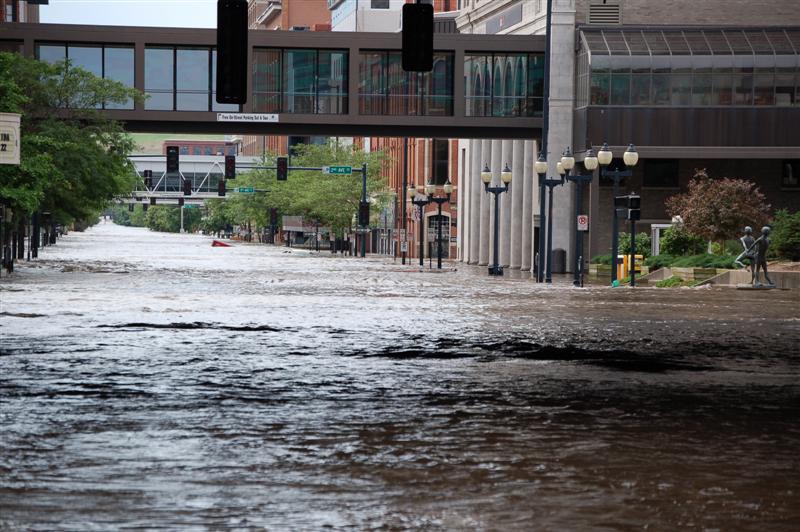
Photo courtesy of USGS
On this date in 2008, city leaders in Waterloo, Iowa were confident that their flood protection efforts were going to be successful against the expected crest of the Cedar River until 2-4 inches of heavy rain fell on the river’s watershed on the night of June 10th.
Officials rushed a plan into place that had been sitting unused since it was designed after flooding in the 1960s: aluminum panels were mounted along eight blocks of the river in downtown Waterloo. The panels held, but flooding backed up along Blower Creek and the western part of downtown Waterloo was flooded.
Still, the flood protection systems held and only 5% of the city’s downtown was impacted. The City had narrowly escaped total destruction of its core from a 500 year flood. The Cedar in Waterloo crested 3.5 feet above any previous flood.
In Cedar Rapids, residents had been expecting a 22 foot flood crest, which was two feet higher than the river had ever gone in the city. Temporary additions to the flood protection system were underway when the disturbing news came that the forecast had been raised to 24.5 feet. This was approaching the level of a 500 year flood. Officials knew that the city could not get ready in time for the higher crest. Sightseers were ordered away and efforts were made to protect the 8th Avenue railroad bridge. And to make matters worse, rain began to fall that night. The river would crest just over 31 feet, or an amazing 19 feet above flood stage, easily an all time record. 1,300 blocks of the city flooded. It is Iowa’s Katrina. Three years later, the slow recovery is still occurring.
On the Iowa River in Iowa City, the river crested just below 31 feet, 9 feet above flood stage and above the point where major flooding occurs on the University of Iowa campus. The record crest was 28.5 feet in 1993. Sixteen buildings on the campus were flooded. While not as bad as Cedar Rapids, the damage was still tremendous.