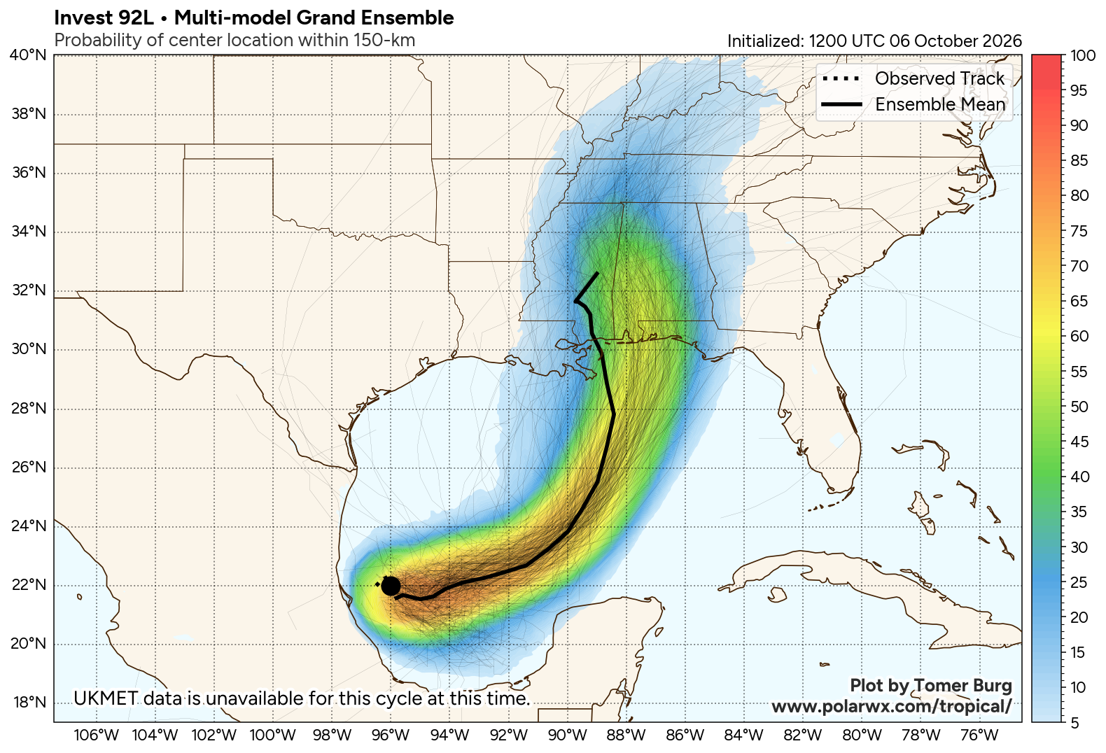
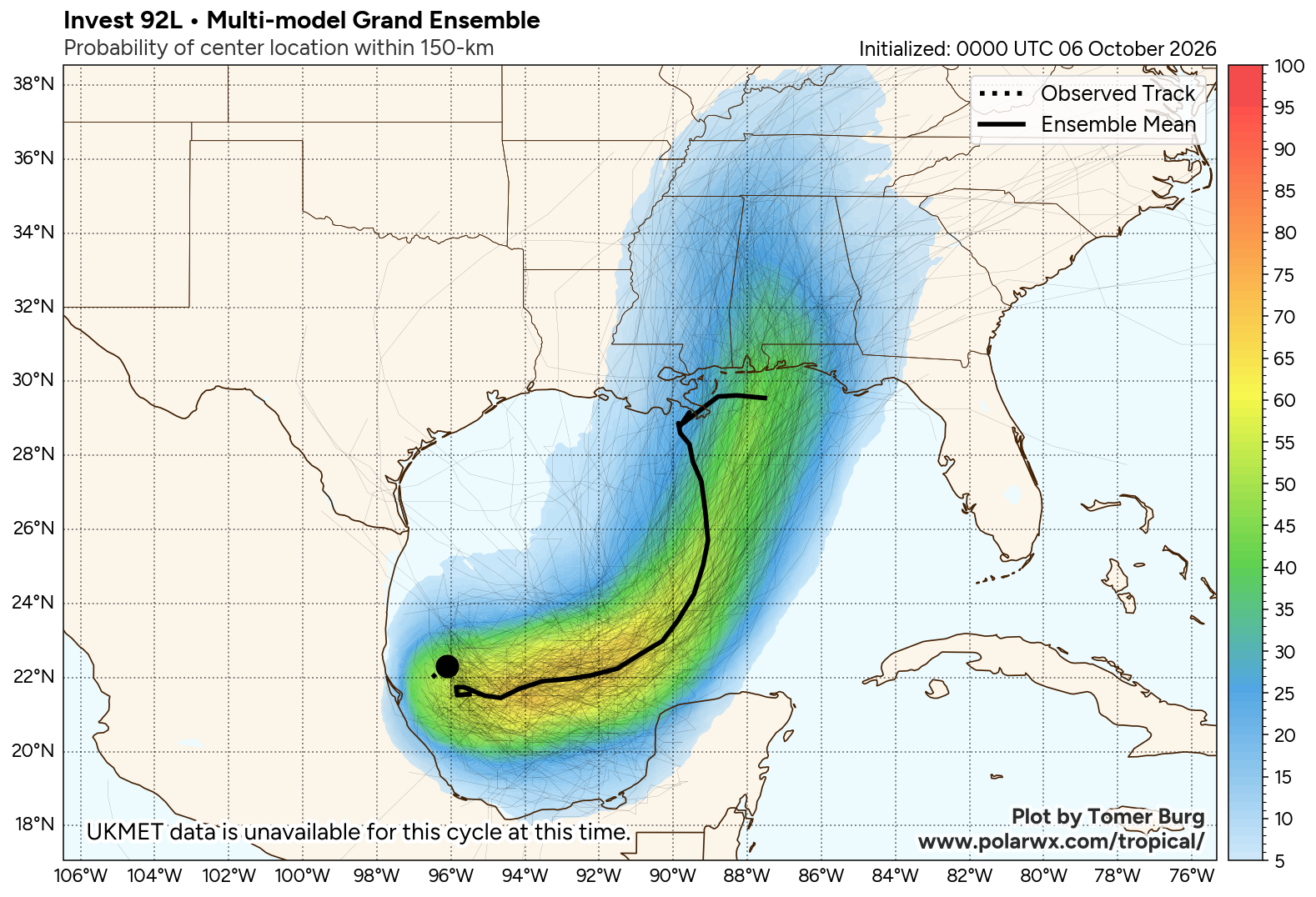
EYES ON ISAIAS: Tropical Storm Isaias this morning has sustained winds of 40 mph, and is about 580 miles southwest of the mouth of the Mississippi River. It is moving to the east/northeast at 8 mph. The latest NHC forecast track pushes Isaias into the Central Gulf Coast near Gulf Shores around midnight Friday night with sustained winds of 90 mph. The circulation then moves through West Alabama during the day Saturday.
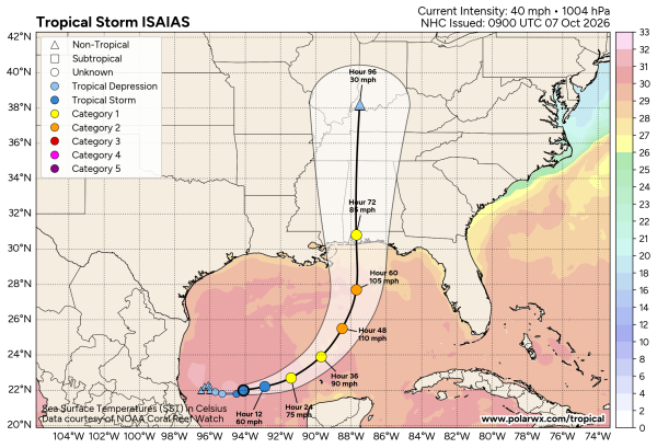
Here are the key messages this morning
*Vertical wind shear then increases quite dramatically in the final 24 hours before Isaias reaches the Gulf coast, though it is looking more likely that Isaias will still be a significant hurricane when it makes landfall. Hurricane and Storm Surge Watches will be required for a portion of the Gulf coast later today. The first storm surge forecast for the Alabama coast and Mobile Bay will from NHC will come later today.
*Near landfall, Isaias will also be interacting with a short-wave trough aloft, likely leading to an expanding wind field. This means rain and wind impacts will extend far from the center on the eastern side of the storm.
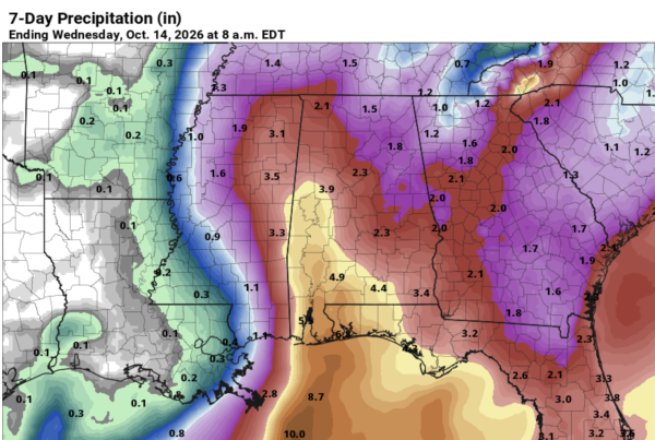
*All of Alabama will see Saturday as the tropical system passes through. Heaviest rain will be from Mobile and Baldwin counties northward through parts of West-Central Alabama, where amounts could exceed 5 inches. North and East Alabama will likely see 1-3 inches of rain from Isaias. The rain will end from the south Saturday night, and most of the day Sunday will be dry.
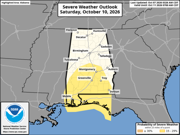
*There is a risk of tornadoes late Friday night and Saturday; SPC currently has roughly the southern half of the state in a severe weather risk Saturday. The air will be relatively stable over North Alabama, which will likely limit the tornado threat there.
*Concerning the National Shrimp Festival at Gulf Shores and the rest of the Alabama coast… the worst of the weather (rain and wind) will come Friday afternoon, Friday night, and Saturday morning. A dry slot should bring an end to the rain Saturday afternoon; Sunday should be a very nice day on the coast.
*Concerning the Alabama/Georgia football game Saturday night… best possible case is for a faster moving system. Rain could end before kickoff with diminishing wind. That is a very real possibility. But, with the current NHC forecast rain is still likely for the game with winds of 20-30 mph. And, a tornado threat is on the table as well with Isaias passing to the west.
*Cocnerning the Zach Bryan concert in Auburn Saturday night… the current NHC forecast would mean a good chance of rain; winds in the 15-25 mph range. Like Tuscaloosa, a faster moving system would bring an end to the rain just before the concert begins, which is a possibility.
*With any tropical system the forecast can change; be sure and watch for updates.
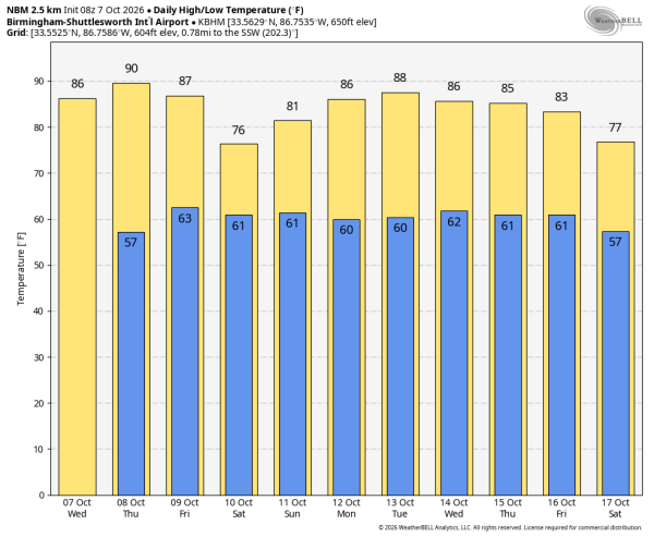
Most of Alabama will be dry Sunday as the system continues to move away from the state. And, at this point next week looks dry with warm afternoons… highs in the 80s. See the video briefing for maps, graphics, and more details.
ON THIS DATE IN 2016: Hurricane Matthew was off the northeast coast of Florida. Matthew brought intense rainfall to the Carolinas on the 8th and 9th.
Look for the next video briefing here by 3:00 this afternoon… enjoy the day!