Since I posted the afternoon discussion a few hours early… a quick peek at how things are unfolding.
First, below is the current 500 mb analysis…
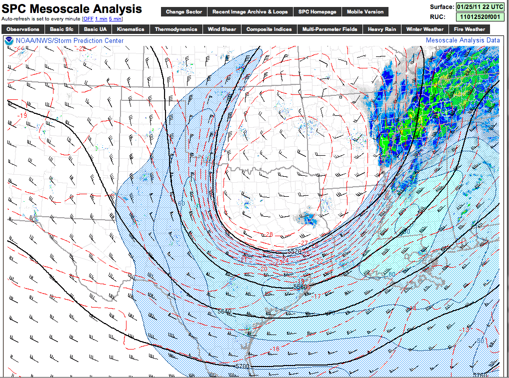
The core of the upper low and the coldest air aloft (-28 C) is over Northeast Texas. This will move east, with the core moving over the extreme northern counties of Alabama early tomorrow morning. Dynamic cooling associated with this upper low and the associated forcing will bring the expected change from rain to snow after midnight.
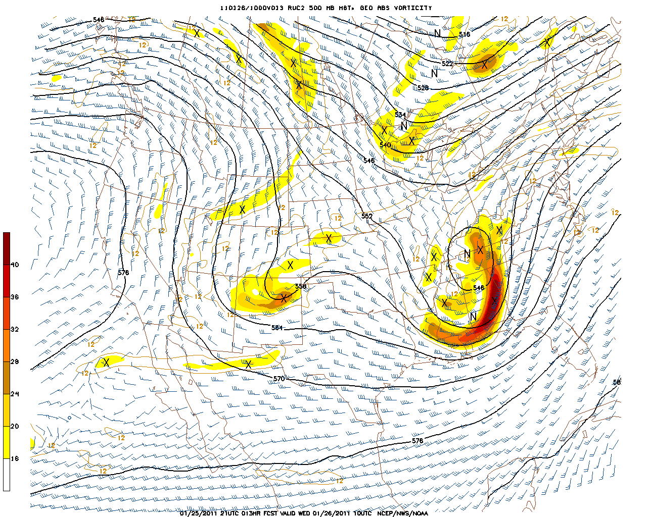
Below is the RUC output at 500 mb, valid at 4:00 a.m. CST… showing the core of the upper low over Tennessee and North Alabama (5460 meters)…
Here is the 18Z RPM output, valid at 6:00 a.m. CST tomorrow…
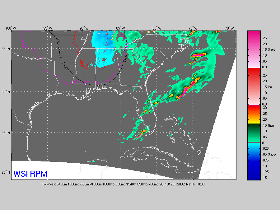
Shows a pretty good band of snow over the entire northern half of the state. Considering the warm infrastructure and the fact that surface temps should be above freezing through the entire event, our ongoing forecast looks fine…
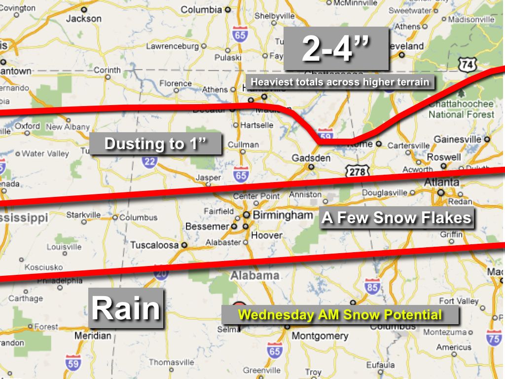
Will be an interesting night to see what surprises this system throws our way. Stay tuned