…A SEVERE THUNDERSTORM WARNING REMAINS IN EFFECT UNTIL 200 PM CDT FOR WALKER AND WINSTON COUNTIES… At 113 PM CDT, severe thunderstorms were located along a line extending from near Russellville to 10 miles north of Ashridge to 6 miles west of Jasper, moving northeast at 50 mph.
HAZARD…70 mph wind gusts.
SOURCE…Radar indicated.
IMPACT…Expect considerable tree damage. Damage is likely to mobile homes, roofs, and outbuildings. Locations impacted include… Jasper, Haleyville, Sumiton, Cordova, Dora, Carbon Hill, Lynn, Arley, Double Springs, Parrish, Oakman, Addison, Sipsey, Kansas, Nauvoo, Eldridge, Curry, Gorgas Steam Plant, Houston Recreational Area and Nesmith.
Severe Thunderstorm Warning Canceled For Parts Of Marion County
Apr 30th @ 12:54 pm
…THE SEVERE THUNDERSTORM WARNING FOR EASTERN MARION COUNTY IS CANCELLED… The storms which prompted the warning have moved out of the warned area. Therefore, the warning has been cancelled. A tornado watch remains in effect until 700 PM CDT for northwestern, west central Alabama.
Severe Thunderstorm Warning Issued For Parts Of Marion, Walker, And Winston Counties Until 2:00PM
Apr 30th @ 12:54 pm
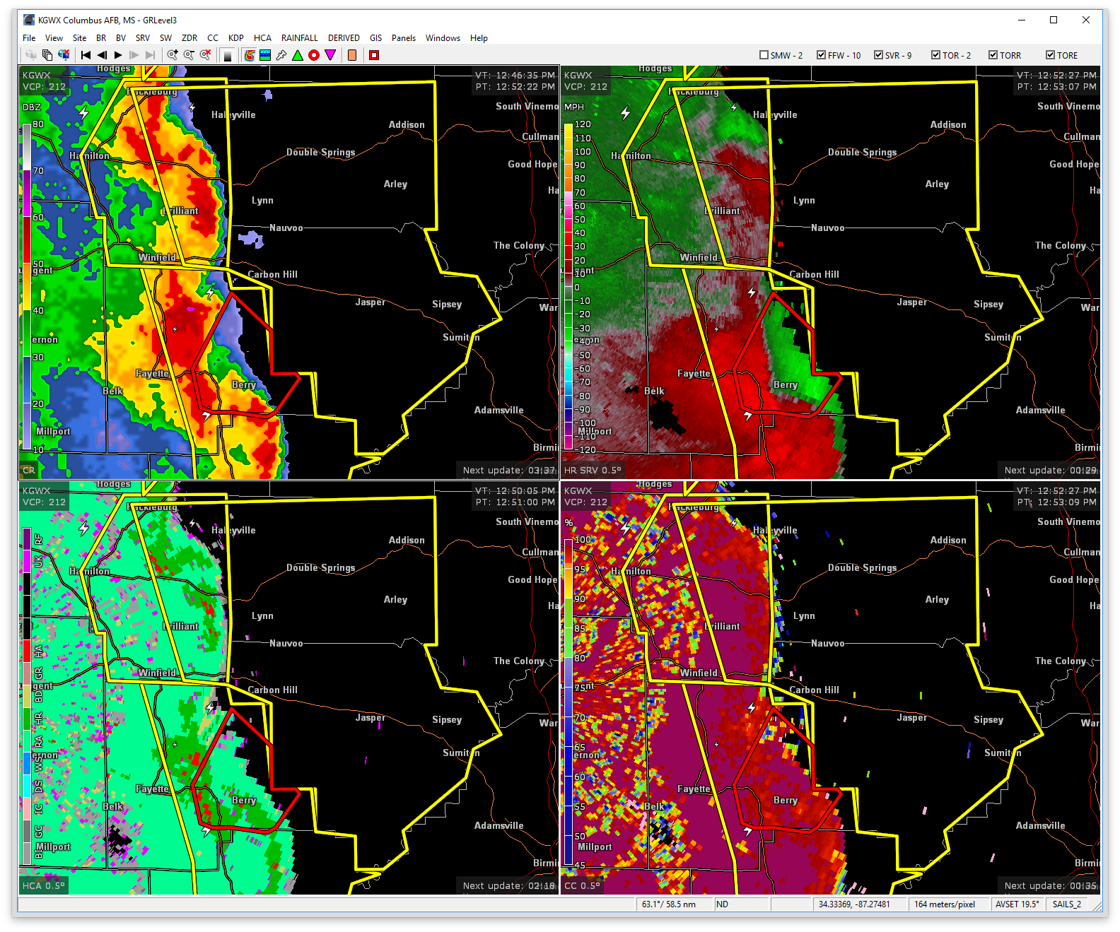

The National Weather Service in Birmingham has issued a
* Severe Thunderstorm Warning for…
Walker County in Alabama…
Eastern Marion County in northwestern Alabama…
Winston County in northwestern Alabama…
* Until 200 PM CDT
* At 1254 PM CDT, severe thunderstorms were located along a line extending from near Hackleburg to near Haleyville to Boley Springs, moving northeast at 50 mph.
HAZARD…70 mph wind gusts.
SOURCE…Radar indicated.
IMPACT…Expect considerable tree damage. Damage is likely to mobile homes, roofs, and outbuildings.
* Locations impacted include…
Jasper, Winfield, Haleyville, Sumiton, Cordova, Dora, Carbon Hill, Lynn, Arley, Hackleburg, Double Springs, Parrish, Brilliant, Oakman, Addison, Glen Allen, Sipsey, Kansas, Nauvoo and Eldridge.