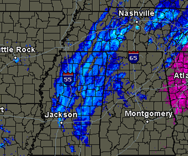
Bands of heavy snow continue to move east through Mississippi and now approaching the state line. Getting reports of snow mixing in with rain and sleet from Sumter, Pickens and Lamar Counties. The bands of snow will continue to move into and through Alabama this morning. The upper-level low that is producing the snow will be working east along the Interstate 20 corridor. As this happens, snow fall rates will increase across the state. Light snow will be the norm, but under the more intense bands, heavy snow fall rates are likely. Snow will be falling faster than it can melt, and that is why we expect to see accumulations. Snow is covering the ground in many locations in Central Mississippi. Seeing a lot of pics from Facebook friends in Starkville, Jackson, West Point and Philadelphia of snow covering most surfaces.
Published on: January 17, 2013 at 7:35 AM
Related Articles
February 22, 2026 at 7:36 AM
Winter Briefly Returns
Today will be cool and windy behind yesterday’s cold front. Lows will fall very low tonight, and strong winds will make them feel colder. Tomorrow will be the coldest day of the week, but winds will begin to die down slightly in the afternoon. Tuesday, highs begin to moderate slowly, then they jump up Wednesday. A cold front will sweep through the state and bring decent rain chances Thursday. Lower rain chances stick around Friday and Saturday as one cold front moves out, and another prepares to move in. Continue reading →
READ MORE
February 7, 2026 at 3:43 PM
Was Punxsutawney Phil Right? How Often is He Right?
This year, after a particularly active month for winter weather, Phil saw his shadow and many aren't too happy with his forecasts. Continue reading →
READ MORE