The NAM, GFS, and the ECMWF are all on board for what could be a pretty decent snow event for parts of Alabama Tuesday evening… below is the 12Z GFS valid at 6:00 P.M. Tuesday…
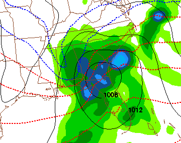
Good model agreement means a higher confidence in the possibility of snow in Alabama sometime between noon Tuesday and noon Wednesday. The position of the surface low suggests the best chance of snow will be over the eastern two-thirds of the state, with potential for over three inches.
I stress it is still way too early to be specific about accumulation amounts and placement, in that there is still some variation in the models about the depth of the cold air and the specific position of the deepening surface low.
Stay tuned for updates…