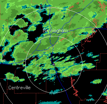
The precipitation is not going away easily in the BHM metro area. Even though it’s moving NE and the back edge is just south of Calera, there is a lot of warm air advection (warm air moving in) aloft, helping to generate new areas of precipitation at the back edge, and making it last a little longer than the radar loops made it look like at 1030 pm.
At the same time, temperatures aloft have warmed to between -2 and -4 C, not really cold enough for a lot of ice crystal formation (snow) in Jefferson, Tuscaloosa, and Shelby counties. So, the precipitation is forming as raindrops, then falling through the cold air and freezing (to form sleet) or freezing on contact with the ground (freezing rain). This is happening now here in Trussville, and in other places around the BHM metro.
While we are not expecting the major icing event we did earlier, especially over south Alabama, we could still see some additional power outages in the BHM metro area before morning. Please don’t drive anywhere tonight or tomorrow morning.