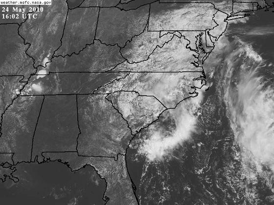
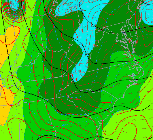
The possibly sub-tropical low that JB posts about below, and a high pressure area in the Northeast, are bringing cool, moist air inland off the Atlantic. Normally, air flows close to parallel to the isobars (black lines), but since the air has trouble getting over the Appalachian mountains, it turns south, going from high to low pressure. This is causing much cooler air to move south through Virginia, the Carolinas, and parts of Georgia. The temperature (red lines) ranges from 88 in Tuscaloosa, to 80 in Atlanta, to 76 in Columbia, to 70 in Mt. Airy, NC. With the cool air moving inland at low-levels, clouds have formed over the east coast. With the hot, humid air in Alabama and the boundary provided by the cooler air to the east, we may see a few thunderstorms develop along the edge of the clouds today.